Pedernales Falls State Park has over 40 miles of hiking trails — from flat riverside walks to rugged backcountry climbs with sweeping Hill Country views. Whether you’re after a quick stroll with the family or a half-day epic, the park has a trail that fits.
This guide breaks down every major trail in the park: distance, difficulty, what you’ll see, and the practical info you need before lacing up.
Trail Overview
| Trail | Distance | Difficulty | Time |
|---|---|---|---|
| Twin Falls Trail | 2.6 mi RT | Easy | 1.5 hrs |
| Pedernales Falls Loop | 4.8 mi loop | Moderate | 2.5 hrs |
| Wolf Mountain Trail | 6.2 mi loop | Moderate | 3–4 hrs |
| Trammel’s Crossing | 5.4 mi RT | Moderate | 3 hrs |
| Backcountry Loop | 10–15 mi | Strenuous | 6+ hrs |
| Madrone Trail | 1.1 mi | Easy | 30 min |
Twin Falls Trail (Easy)
Distance: 2.6 miles round trip
Difficulty: Easy
Trailhead: Twin Falls parking area
Elevation gain: Negligible
The most popular hike in the park and for good reason. This out-and-back trail winds along the Pedernales River through cypress groves and limestone outcrops to a set of cascading falls and clear swimming pools.
The trail is mostly flat with a few rocky sections. Suitable for kids, casual walkers, and anyone who wants the river experience without the climb.
What you’ll see: Bald cypress trees, river otters (rare but possible), wildflowers in spring, swimming holes at the end.
Tip: Go early. Parking fills up by 10am on weekends, and the swim spots get crowded by noon.
Pedernales Falls Loop (Moderate)
Distance: 4.8 miles loop
Difficulty: Moderate
Trailhead: Falls overlook parking
Elevation gain: ~250 feet
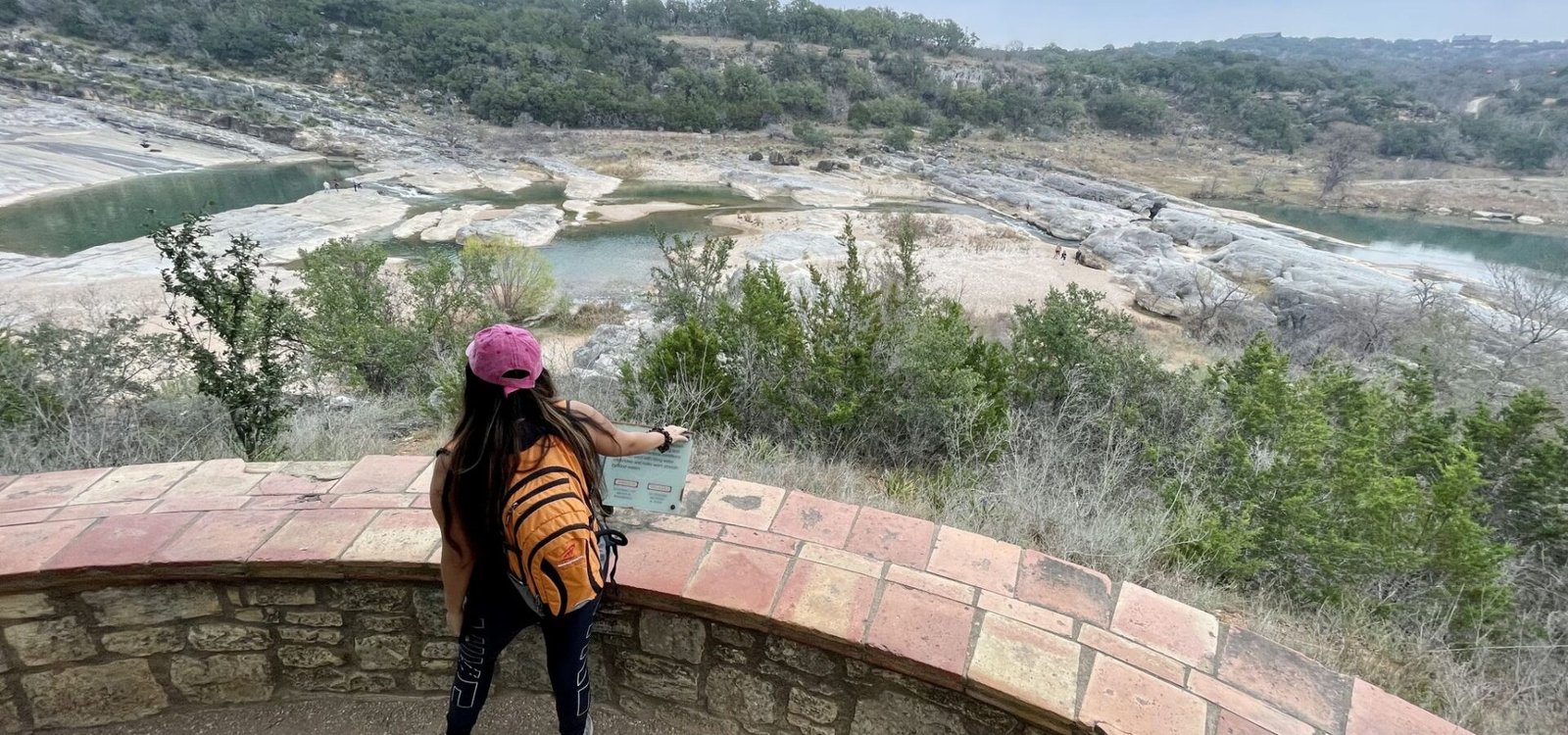
This loop takes you to the park’s namesake feature — the wide, stepped limestone shelves where the Pedernales River drops through a series of dramatic cascades. The falls are most impressive after rain.
The trail descends to the falls overlook, climbs out via a cedar-shaded ridge, and loops back through prairie and oak woodland.
Important: Swimming at the main falls is strictly prohibited. The currents above and below the drops have killed multiple visitors. Stay on marked overlooks.
What you’ll see: The falls themselves, layered limestone cliffs, prickly pear cactus, white-tailed deer.
Wolf Mountain Trail (Moderate)
Distance: 6.2 miles loop
Difficulty: Moderate
Trailhead: Wolf Mountain parking lot (west side)
Elevation gain: ~400 feet
The best all-around hike in the park. You’ll climb to the top of Wolf Mountain through juniper-oak woodland, traverse a ridge with panoramic Hill Country views, then descend through a creek drainage back to the trailhead.
This is the trail to pick if you only have time for one hike. It hits everything Pedernales Falls offers — terrain variety, wildlife, views, and solitude.
What you’ll see: Hill Country panoramas, white-tailed deer, occasional armadillos, wildflower fields in spring, hawk and vulture overhead.
Tip: Start clockwise to get the climb out of the way early. The descent on the second half is gentler.
Trammel’s Crossing Trail (Moderate)
Distance: 5.4 miles round trip
Difficulty: Moderate
Trailhead: Trammel’s parking area
Elevation gain: ~200 feet
A quieter alternative to Twin Falls. This trail follows the river upstream past several small swimming pockets and ends at an old wagon-trail crossing. Less crowded than the popular trails, with similar river scenery.
What you’ll see: River views, swimming holes off the main beat, historic crossing site, plenty of shade.
Backcountry Loop (Strenuous)
Distance: 10 to 15 miles depending on route
Difficulty: Strenuous
Trailhead: Equestrian/backcountry parking
Elevation gain: 600+ feet cumulative
The western half of the park has a network of multi-use trails (hikers and equestrians) that string together into longer loops. These are less maintained, less marked, and far less traveled — which means solitude, but also means you need to know what you’re doing.
Bring a paper map (the park visitor center has them). Cell service is unreliable. Carry at least 3 liters of water per person and tell someone your route.
What you’ll see: Untouched Hill Country landscape, wildlife, almost no other people.
Madrone Trail (Easy)
Distance: 1.1 miles
Difficulty: Easy
Trailhead: Near visitor center
Elevation gain: Minimal
A short interpretive trail near the visitor center, named for the Texas madrone trees scattered along the route. Good for kids, anyone short on time, or a warmup before a longer hike.
What you’ll see: Texas madrones (rare in this region), interpretive signage, oak and juniper.
What to Bring on a Pedernales Falls Hike
Always Pack
- Water — At least 2 liters per person for any hike over 2 miles. 3+ liters in summer.
- Closed-toe shoes — Limestone is sharp, uneven, and unforgiving in sandals.
- Sun protection — Hat, sunscreen, sunglasses. Most trails have limited shade.
- Snacks — Pack salty snacks for sodium replacement in heat.
- First aid basics — Bandaids, blister care, tweezers (for cactus spines).
- Trail map — Cell service is spotty. Pick up a paper map at the visitor center or download an offline map.
Summer Additions
- Electrolyte tabs or sports drinks
- Cooling neck towel
- Extra water (3–4 liters minimum)
- Wide-brim hat instead of baseball cap
Winter Additions
- Layers — mornings can be 30°F, afternoons 65°F
- Light gloves
- Lip balm
Trail Etiquette and Rules
- Stay on marked trails. The limestone landscape is fragile and many trails skirt sensitive habitat.
- Pack out everything you pack in. There are no trash cans on most trails.
- Dogs must stay on a 6-foot leash. Pick up after them.
- Do not pick wildflowers, rocks, or anything else. Take photos only.
- Yield to horses on multi-use trails — step downhill of the trail and let them pass.
- No drones. No mountain bikes on hiking-only trails (see mountain biking guide).
Wildlife You’ll Likely See
- White-tailed deer (everywhere, especially dawn and dusk)
- Wild turkey
- Armadillos
- Roadrunners
- Various lizards and small snakes
- Vultures and hawks overhead
- Painted buntings and other migrating songbirds (spring/summer)
What to avoid: Rattlesnakes are present but not common on trails. Watch where you step and place hands when scrambling. Cottonmouths can be near the river.
Best Time to Hike
Spring (March – May) is ideal. Wildflowers carpet the prairies, temperatures stay in the 60s–80s, and creeks are running.
Fall (September – November) is the second-best window — cooler temperatures, fewer bugs, golden light.
Summer (June – August) is hot. Hike at sunrise or after 6pm. Avoid the exposed Wolf Mountain ridge in the afternoon.
Winter (December – February) is underrated. Cool mornings, brilliant clear days, no bugs, and the trails are nearly empty.
Trail Safety Tips
- Tell someone your plan. Especially for backcountry routes.
- Start early. Avoid the heat and the crowds.
- Watch the weather. Flash floods can close river-adjacent trails with little warning.
- Don’t trust GPS for the backcountry. Carry a paper map.
- Know your limits. The 6-mile Wolf Mountain loop in 100°F heat is harder than it sounds.
Trail Combinations
If you have a full day:
- Morning: Wolf Mountain Trail (3–4 hrs)
- Lunch: Picnic at Twin Falls trailhead
- Afternoon: Twin Falls Trail to swim and cool off (1.5 hrs)
That’s about 9 miles of hiking, a swim, and you’ll see most of the park’s signature terrain.
Pedernales Falls is a hiker’s park. The terrain has variety, the trails are well-marked on the popular routes, and the river-canyon-prairie combination is hard to find anywhere else in central Texas.
Want personalized trail recommendations? Contact us — we’ll point you to the right trail for your group.
This page contains affiliate links. We earn a small commission at no extra cost to you.